22W04 — Sespe Trail Uncovering a Lost Gem of Singletrack
The trills from the creek are incessant. Goldfinch and Kinglets chirp songs across resonances that I cannot spell using the alphabets I know.
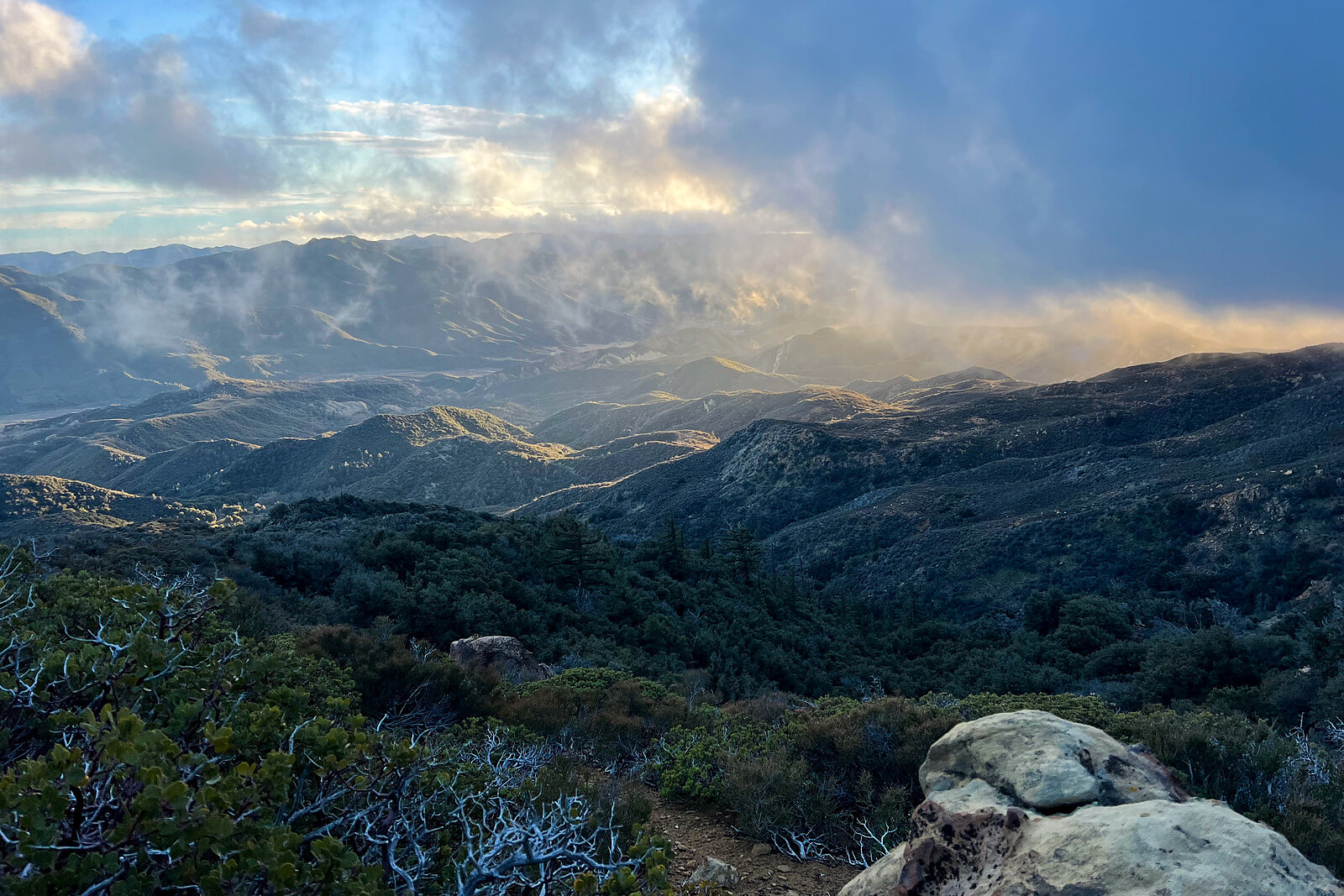
It’s early, I’m still in my sleeping bag, and a still-brewing kettle means caffeine has yet to awaken my senses. The calendar suggests it’s spring, yet unzipping the tent flap brings a dry cold to my face that feels a lot like winter air rolling in. Frost falls from the bending wild rose hips and willow boughs as spooked quail run for cover. I gaze west across rolling hills of chaparral, past the waterfall cascading down cliffs of ancient seafloor, beyond the 1,000-foot-wide white blocks of limestone rising like whalebacks over a rough green sea. From here I can see the remains of a fire tower put up 100 years prior. Now it is little more than rusted bones of its original glory and purpose, the wooden cabin top having been stripped in the 1970s, leaving behind a perforated platform atop steel legs set into rebar and concrete.
Noise emanates from a cattle herd grazing not more than 400 yards down valley, just beyond which a half-dozen leather-clad bikers atop Harleys rumble up Highway 33. That road, better known as the Maricopa highway, runs north-south through, up, and over the easternmost extremities of the Santa Ynez Mountains, connecting the port city of Ventura, California to the oil-rich inlands of the Central Valley.
The intermittent rumbles of engines breaking birdsong reminds me how this place has always been a corridor of commerce, a landscape traversed by those struggling to support a livelihood upon it. A rough passage of this road was conceptualized in 1890, winding down 5,000 feet of elevation to connect early homesteaders ranching and trapping within the confines of America’s first forest reserves to the county seat, largely for the sake of paying their taxes and selling a variety of wares. It would be 40 more years before it was paved over in an amended form for vehicular travel, and only so by the grace of the Civilian Conservation Corps being founded to pull America out of The Great Depression.
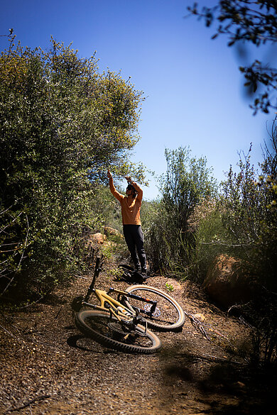
On a mild day in May, I push through thickets of ceanothus and wild rose, tracing the faint line of a forgotten trail. I’m here to uncover and restore a piece of singletrack that tells the story of this landscape: its people, its passage, and the persistence of movement across time. Today’s road is more so a trail, as the ground it lies upon was compacted by those who came long before California was a U.S. territory, before the land was under flagged boundaries of the Mexican government or the king of Spain. Far before, this road was truly a trail—set into the land by the feet and wooden wheels of carts of the Chumash people who traveled across Central California from their origin on the Channel Islands amidst the Pacific Ocean, hunting, gathering, and trading for thousands of years. It is this proto-road trail that I am after, the one unused when asphalt was laid, the one now hidden within the sagebrush, the one with history, depth, and connection to landscape beyond Strava times, the invention of the mountain bike, the popularization of hiking, and the enlightenment period.
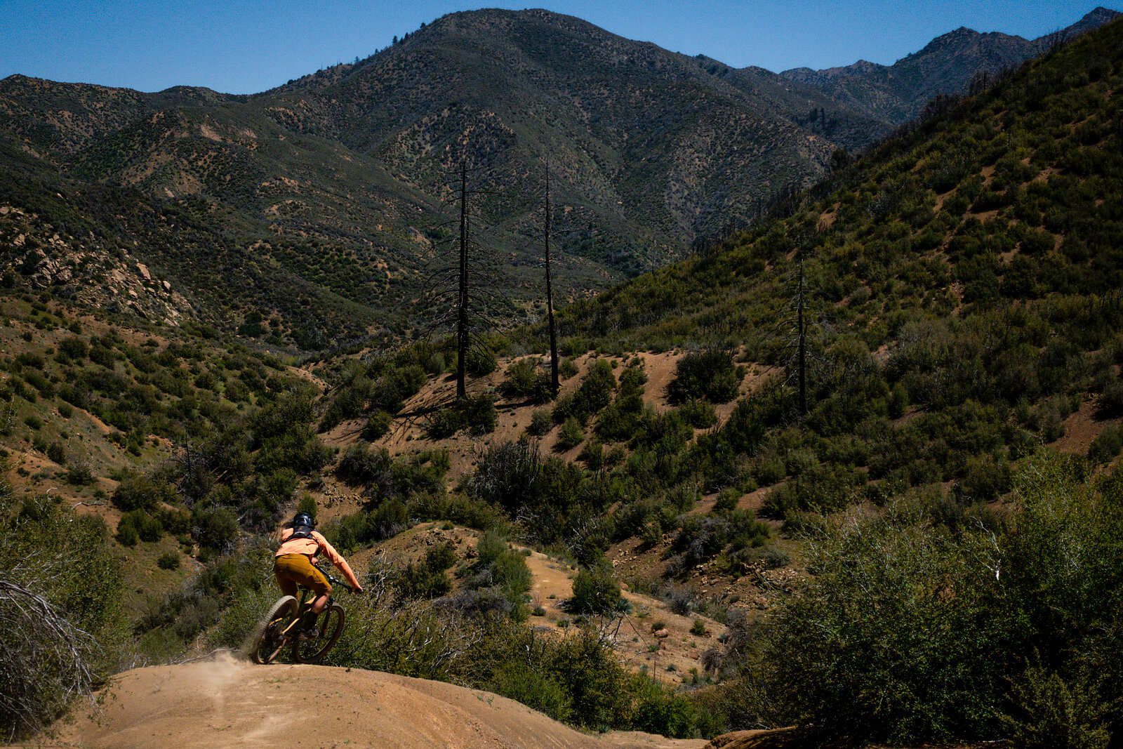
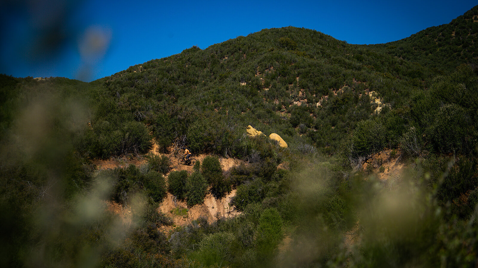
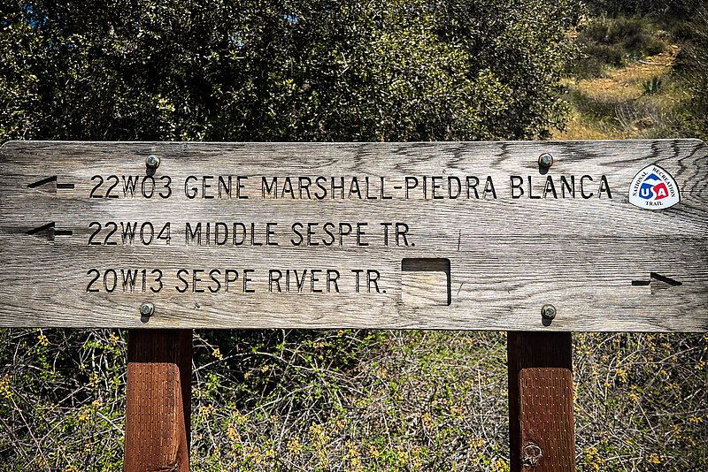
The spur of trail I seek to bring back to the world is inventoried in the U.S. Forest Service’s catalogue as 22W04 — Sespe Trail, named after the creek it runs along. For 7.5 miles this path undulates across 30-million-year-old sandstones and shales, providing 1,500 feet of descent along its corridor. In winter, tire lugs dig into a soil that hugs the rubber back as tunnels of royal blue, white, and yellow from flowering ceanothus and fiddleneck overwhelm the horizon. In summer, hard stones break loose from friable dirt, turning cornering into more so an act of skips and drifts with the pointed ends of agave threatening to draw blood from any overcooked confidence. Even accounting for the disjointed contrast of character, it is trails like this that speak to a relationship between people and place. And, for that, they deserve our stewardship and respect. That stewardship begins with finding what has been lost.
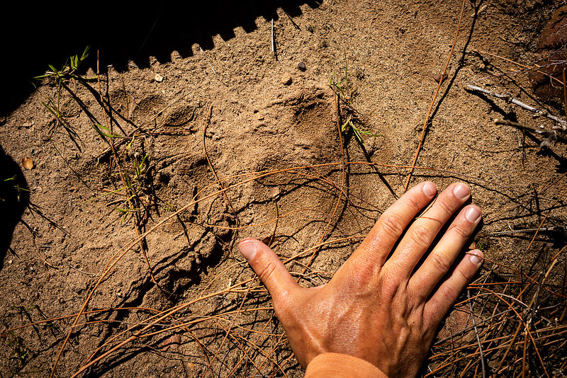
The initial spark of existence of Sespe is noted in a map from 1840, scribbled onto a slab of parchment paper in charcoal denoting the land grant ownership deed given to a rancher by the governor of Mexico. Known as Diseño, these layout maps would eventually be transferred to the U.S. government after the signing of the Treaty of Guadalupe Hidalgo in 1848 following the end of the Mexican-American War in the hope that land ownership of private citizens would be respected regardless of their citizenship. However, it was during that same war that a man by the name of Jesse Jefferson Howard would take a bullet whose lead he would carry for the next 40 years of his life. Howard was to move west under the Homestead Act of 1862, first becoming a miner along with much of expansionist America, then falling into trapping and hunting after failing to strike riches. It is in newspaper clippings from Ventura in the late 1800s that tales are recounted of Howard’s hunting of grizzly bears from his home within Rose Valley along the Sespe Trail. In town, he sold the meat for 22 cents a pound, part of a century long culture that would drive the species to extinction.
Eventually those recounted stories turned to Howard’s shooting of a trespassing Basque sheepherder during a drought year, not that this made him a bad man by the standards and mores used in passing judgment in the old American West. His court appearance, escape from jail, lam to Arizona, and eventual death at the age of 92 would all be forgiven and celebrated with the naming of the trail that connected his homestead along Sespe to the flat spot atop the mountains where that fire tower’s skeleton stands today.
By 1908, before the establishment of the U.S. Forest Service, the trail shows up in faint, dashed lines as an access to mines, water sources, and one of the last standing homesteads within the forest reserve. Cartography from 1926 depicts the trail as a spur from a newly established wagon road, providing connectivity to hot springs and a school cabin. In 1933, 35,000 people gathered on the far side of the mountains to celebrate the paving of that wagon road, the name Sespe being mentioned on their brochures as a place of healing waters and respite from hot summers. The 1967 map underscores just how successful the commodification of recreation had become with fishing, camping, and wildlife refuge polygons smattered across the map area surrounding Sespe Trail.
By 1982, Victor Vincente, an oft-forgotten legend of the invention of mountain biking, held a two-day bike race from the town of Ojai, across this trail to hot springs for a night of revelry, followed by a trip up Howard Trail and down a fire road that had, by then, been built and abandoned as an access road for the construction of the fire tower. The trail burned under the flames of wildfire in 2002, 2006, and 2017, each time becoming more impassable as shale eroded over its tread just as fast as chaparral could regrow in the negative space of travel just above.
In the half-decade since the last lick of fire, Sespe and the history of passage it held had nearly vanished as budgets thinned and recreation slipped further down the list of priorities for public land management. When I first arrived, the trail was little more than a memory—overgrown, eroded, and fading from the maps. Over the course of a month, I set out to bring it back, cutting through chaparral and rebuilding the old bench one short stretch at a time. Some days I cleared only a few hundred feet, but by season’s end the entire corridor of the Sespe Trail was open again, a line of travel restored through the same landscape that shaped those before us.
Now, paired with the revival of Howard Trail at its western terminus and Lion Canyon at its eastern, Sespe once again forms a continuous 22-mile loop with 4,000 feet of descending—a veritable dream of what a mountain bike ride should be. It is through that labor, the mix of restoration, research, and reverence, that we move not just forward but deeper. Each swing of the tool and each rediscovered turn cuts into the reasonings, lives, and means of the people who once passed this way.
None of this is truly new. The center pillar of mountain biking and the connection between people and place rests on thousands of miles of trails and thousands of years of passage, eroding from landscapes, fading from parchment, waiting for someone to find them again.