Hop, Skip, Jump Bikepacking by Helicopter in the Ozarks
As the Huey helicopter lifted off from Thaden Field in Bentonville, Arkansas, the fervor of suburban development quickly gave way to a vast sea of rolling green. In an instant, we were gazing over the Ozark Mountains, a large highland plateau region covering a portion of northern Arkansas and southwestern Missouri.
The aerial perspective above a blanket of oak, hickory and pine forests heightened our anticipation of what we would find on the ground. I sat up front with our pilot, Chad Cox, while my adventure buddies, Corie Spruill and Kaysee Armstrong, sat on a bench seat behind me. Our bikes and bikepacking bags were carefully tucked into every nook and cranny around them. In 28 air miles, the distance to Trigger Gap, we would land on a grassy airstrip mowed on top of a mountain. Here, we would start our experimental bikepacking mission—a 180-mile route through the backcountry of northwestern Arkansas .
After unloading the gear and assembling our bikes along the edge of the runway, the whomp, whomp, whomp of the helicopter rotors reverberated in our ears. Chad, the general manager of Summit Aviation and an advocate for aviation-based recreation, lifted up the Huey and was soon a small speck in the sky. We were on our own.
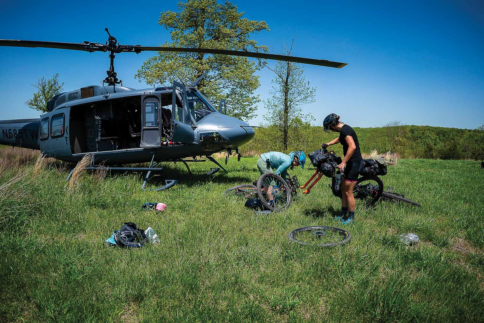
THE WHOMP, WHOMP, WHOMP OF THE HELICOPTER ROTORS REVERBERATED IN OUR EARS. CHAD LIFTED UP THE HUEY AND WAS SOON A SMALL SPECK IN THE SKY. WE WERE ON OUR OWN.
I felt a mixture of excitement and anxiety. We had a rugged trip ahead of us. Even if everything went smoothly, covering 180 miles on mostly gravel roads and singletrack over six straight days would be a formidable challenge. The route was remote, and the weather forecast was calling for a lot of rain. This was a particular concern because there was a major water crossing toward the end of our route, and there was no guarantee we’d be able to cross. All of this meant that we had to be prepared for long days and carry ample provisions in case things went sideways.
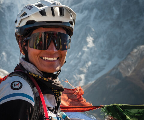
Despite the challenges, I was supremely confident in our team. Corie and I had worked together over the years, and I knew her infectious energy could light up a day brighter than the sun. And as a former mountain bike guide, she is a master of many talents. Though I had yet to travel with Kaysee, as a professional cyclist with deep roots in the outdoor community of Knoxville, Tennessee, I knew she would be a stellar addition to the team.
With all of our gear cinched firmly on our bikes, we pedaled up the Trigger Gap runway and onto County Road 507. Rural farms lined the route for the first day and a half and we reveled in the pastoral bliss, with plenty of cute farm animals to keep us distracted from the constantly undulating terrain. With fresh legs and blue skies, we were able to put a lot of ground behind us.
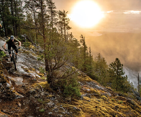
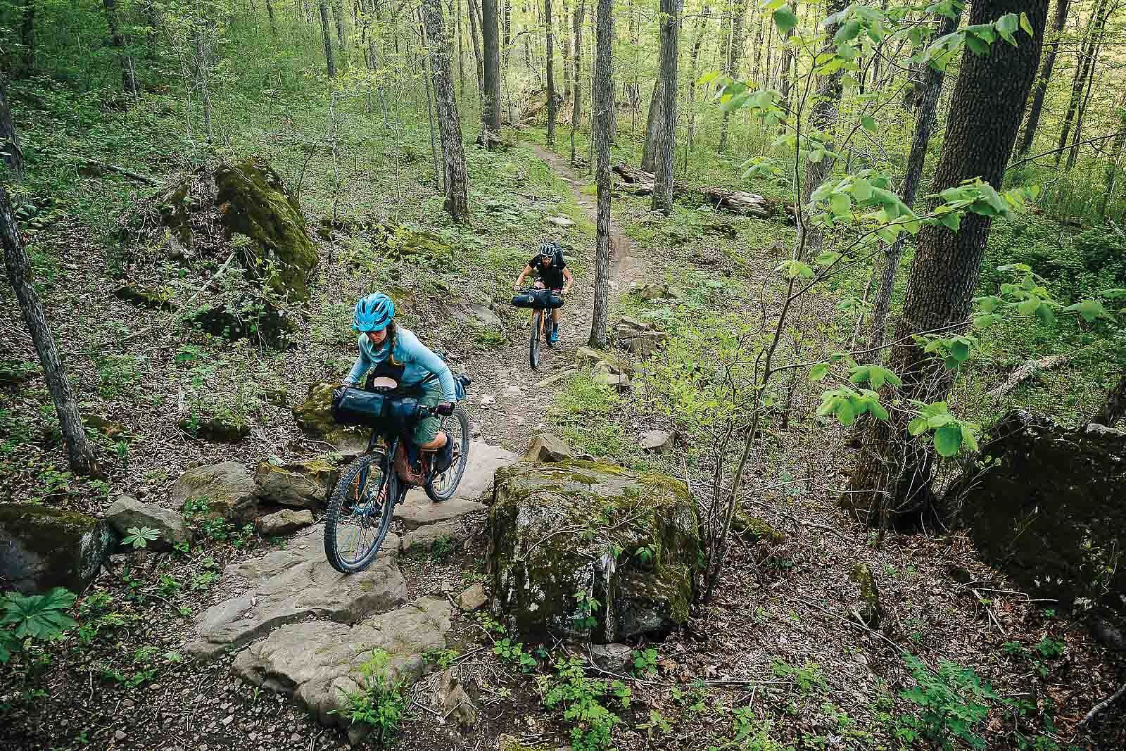
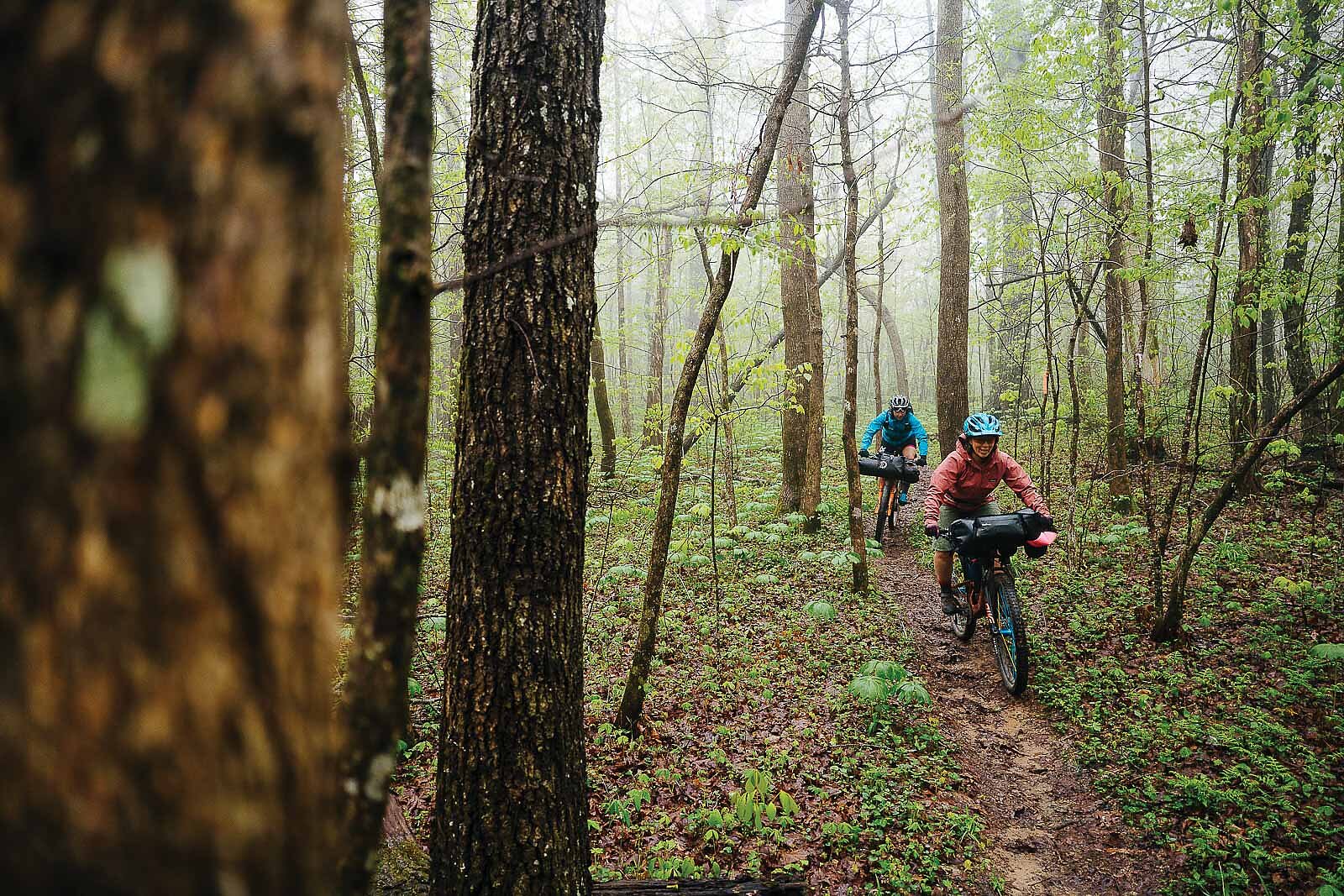
Toward the end of the second day, we hit our first stretch of singletrack at the Buffalo Outdoor Center near Ponca, Arkansas. Starting at the trail system’s highest point, we dropped in for a top-to-bottom run of bike-optimized routes. We quickly remembered how precarious it could be to ride singletrack on a fully loaded bike, with the weight-to-maneuverability ratio making bike handling tricky at best. We started a descent of a black-diamond trail, but after some near-miss crashes, we hike-a-biked our rigs to the nearest blue trails so we could more easily descend underneath the towering cliffs while keeping the rubber side down.
Toward the bottom of the 4.5-mile descent, I checked my phone for the time and was surprised to see it ringing with a local Arkansas number. It was a woman named Kris, from a bunkhouse in Ponca where we were to stay for the night. She said they would be closing soon, and we worked out the logistics for a late arrival, including two bags of potato chips and quarters for hot showers. She also mentioned that if we were to show up in the next hour, she would open up the general store so we could buy groceries.
That was all the encouragement we needed to get a move on. We’d burned more calories than expected and had a limited number of dehydrated meals for the entire trip, so we pinned it down the trail and rolled into town just in time for a shopping spree. We seized the golden opportunity to top up our calorie intake for the trip, snapping up items like chips, cheese and a stick of salami. After spilling our goods onto the counter and settling up with Kris, we bobbled across the highway to our bunkhouse for hot showers and a good night’s rest.
We woke up the next morning to rain and a forecast of thunderstorms throughout the day. With the distance we needed to cover, there was no time for delay, so we pulled our hoods over our helmets and mentally prepared for a hard day, comforted by the fact that a cozy cabin with a woodstove was waiting for us at the end. As we rolled down the highway toward Cave Mountain Road, pavement eventually gave way to dirt and a steep, 900-foot climb. As we ascended into the mist and heard thunder rolling in the distance, Kaysee announced the first of a series of thunderstorms. The rain was polite at first, but it quickly became a deluge and soaked us from head to toe. Even my shoes were completely filled with water
The rain was coming down so hard it was clear that we needed shelter, so Corie and I coasted into the yard of a small, white church and peered inside through a broken window. To our surprise, the door was open, so we let ourselves inside and waited out the rest of the storm.
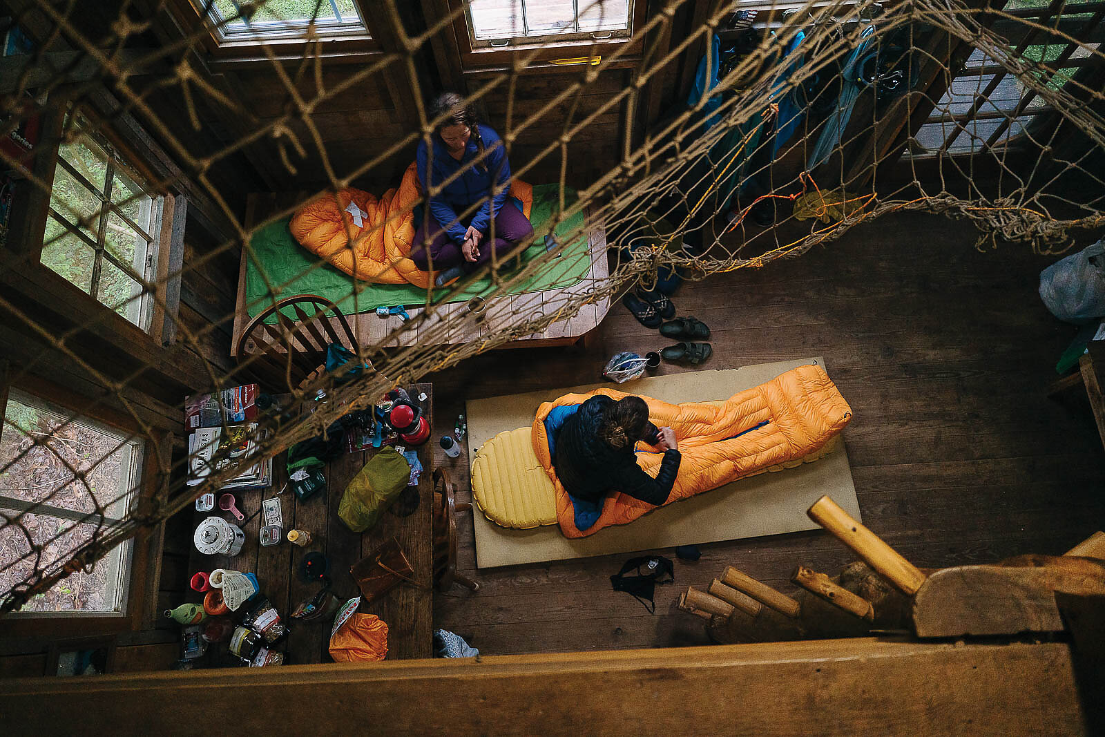
After about an hour, we were back on our bikes and had to make a tough decision to bypass a major section of singletrack that would have taken us to our accommodation for the evening, the rustic BuffaloHead Cabin in Pettigrew, Arkansas. The heavy rain was sure to have made the trail wet and sloppy, and we were really starting to feel the miles in our legs. We agreed it was more important to detour toward dry clothes and rest up for the days still ahead. As luck would have it, we were caught in one last downpour about a mile before the cabin, thoroughly soaking us once again. It felt like Mother Nature was reminding us that adventure isn’t always sunny skies and easy pedaling.
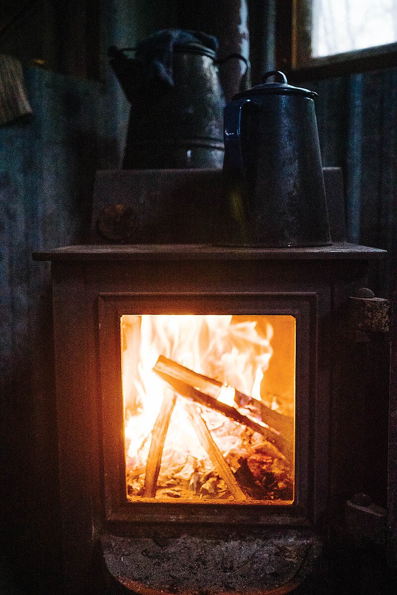
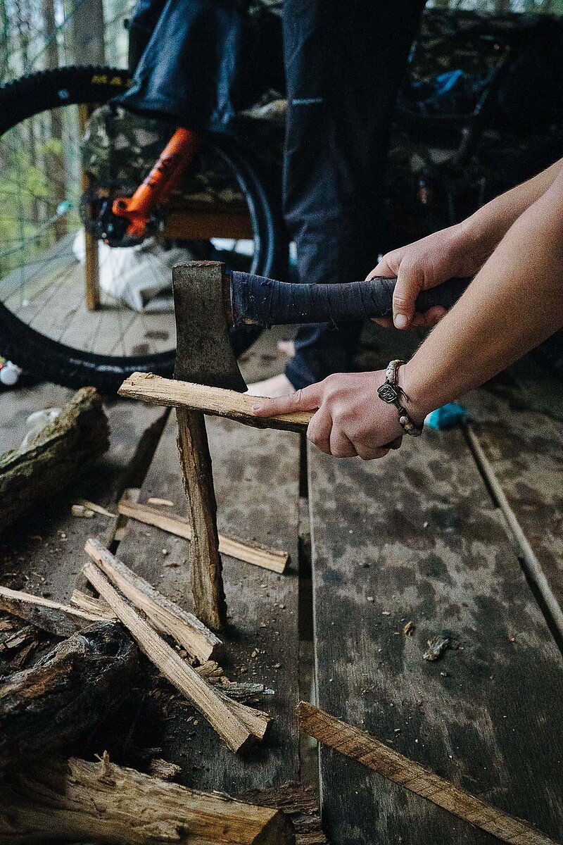
As soon as we reached the cabin, Corie began chopping wood and we built a nice fire to dry our clothes. It had been the hardest day of the trip so far, but our spirits were still high. We knew we needed to take advantage of the warm fire and regroup for the days to come.
We were smart to have rested up because the next day was a beast, starting with the realization that I had miscalculated our distance by 15 miles. What I had thought would be a 35-mile route was actually 50, but my teammates took it in stride and stayed outwardly positive for most of the day. Around 4 p.m., Corie announced that if we weren’t close to our destination of Elkins by 6:30 p.m., she was going to hitch a ride into town and have a margarita. I nodded affirmatively, but I secretly expected our chances of being anywhere other than a rural road at 6:30 to be slim.
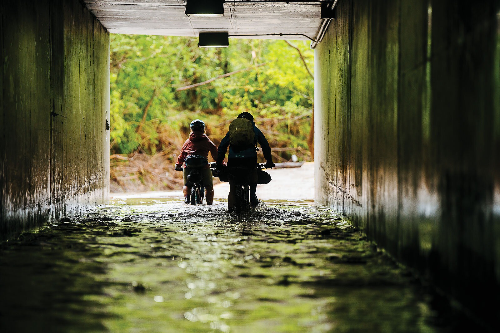
At 5:15 p.m., we were standing on the wrong side of a swollen and swift-moving creek, and the prospects of us getting our bikes and bags across seemed bleak. I waded into the rapids a few times, only to be turned back. It felt like the bikepacking gods were giving us the middle finger, but after walking upstream a bit we found a flatter section where the water was moving more slowly. I grabbed a big stick from the shore and began probing my way across, finding safe passage to the other side. Corie and Kaysee began offloading their bags so we could shuttle our gear across, and by 6:30 p.m. everything was on the other side of the creek. But we were still nowhere near Elkins, and there was zero vehicle traffic along this rural road. Our chances of hitching a ride into town seemed small.
By the time we turned onto the main highway that led into Elkins, we were running out of daylight. We stopped alongside the highway to check our phone navigation to our lodging, when Corie noticed a man standing outside a house. As Kaysee and I were fumbling around with Google Maps, we heard Corie say to the man, “You can say no if you want to.” Before we knew it, we were loading our bikes into the back of the man’s truck and making a beeline for Elkins.
We asked the man, named Chris, to take us straight to a Thai restaurant we’d found online. We arrived at 7:55 p.m.—five minutes before closing time—and I bolted through the doors and said a friendly hello to the teenage girl behind the counter. We were tired, hungry and determined to get a proper meal. The owner emerged from the kitchen, took one look at us and actually invited us into the kitchen to wait while our meal was being prepared. As we enjoyed our piping-hot bowls of chicken tom kha soup, we could feel much more than just the sustenance the food delivered. We could feel the generous humanity of our host.
We woke the next morning to dark clouds and saw the forecast was calling for yet more rain. We quickly decided to pull the ripcord on our planned route for the day because it entailed a lot of dirt roads that would certainly be muddy. Instead, we opted for a shorter, more direct paved route into Fayetteville that would allow us to conserve enough energy to complete the entire route the following day. It turned out to be a wise decision, as we later found out that there had been torrential rain and flash flooding along our original route.
On our final day, we ate a hearty breakfast and started pedaling north on the Razorback Regional Greenway to our final destination of Bentonville. The storms had left some serious damage in their wake, with flood debris everywhere. Bridge railings had been torn from their foundations and crayfish were scattered all over the bike path. Kaysee even rescued a fish that had been washed out of the creek and was gasping for air.
It seemed altogether fitting that we were hit with one final deluge only 15 minutes from the end of our trip, giving us an even greater sense of accomplishment when we finally rolled into the parking lot of our Bentonville hotel. The only question remaining was whether Corie would finally get that long-desired margarita.