Challenger Deep A Descent to the Bottom of the World
We know less about the deepest points on our planet than we do about the surface of Mars. More than 6,600 individuals have summited Mount Everest, and yet only 27 have reached Challenger Deep, the deepest point of our ocean. Located at the bottom of the Mariana Trench in the western Pacific Ocean, this pitch-black canyon lies 35,814 feet below the surface.
Pulled perhaps by the human tendency to seek out places unknown and feats unconquered, cyclists have, in the last half-decade or so, become entranced by the concept of “Everesting.” The idea is simple: Pick any hill, anywhere in the world, and ride repeats of it in one go until you finally accumulate 8,848 meters (29,029 feet) of elevation gain. This concept has been accomplished via road and mountain bike over 27,000 times by those wishing to prove indefatigable spirit and quads. Pretty cool, if you’re into that sort of thing.
But, as much as I enjoy mountain biking, I don’t much fancy the idea of staring at my handlebars for 10 hours or more in search of a Strava file, nor do I have machinations that I will learn something world-shattering about my psyche during such a masochistic quest. As both a professional geologist and an amateur ethnogeographer, I’ve instead come to find an obsession with depth, in both the spatial and temporal senses, more so than distance or speed. The fixation on Everest, seemingly being that of conquering a hill and perhaps being the fastest to do so, does not exactly speak to me as meaningful or fun.
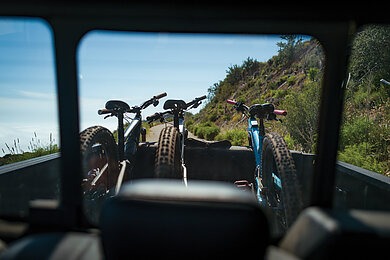
So, in an equal and opposite reaction to the Everesting fad, I set out on a mission to get fully, unequivocally, “trenched.” The premise of the ride would be to reach the total elevational descent of the deepest point on Earth, without repeating trails, and with as much uphill gain as possible achieved through shuttling.
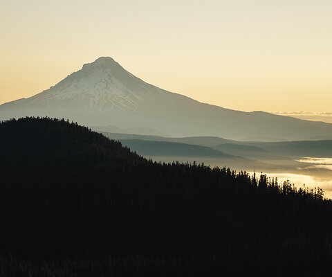
In staying true to the purpose of this ride—one of depth and reverence—there would be no better place to try this than on the trails that branch out from and around my home. It is where I do the grand majority of my trail work, it is where I do most of my riding, and it is where much of my day-to-day community exists. From my little cabin in Ojai to the beach adjacent to Santa Barbara to the vineyard laden valleys of Santa Ynez, this little patch of central California holds a special place in my heart. It’s also home to some of the fastest geologic mountain uplift rates in the world, creating between 4,000 and 8,000 feet of relief across the Transverse Mountain Ranges of the Santa Ynez, San Rafael, and Topatopas. Across these scalloped mountains, blue skies beam down across a litany of trails—all of historical origin—within the Los Padres National Forest. Thankfully, historic trails often form a network which, over time, tends to include a few roads due to the metastasizing nature of human development.
As I poured over maps and studied possible routes, I realized a few other important parallel goals were paramount to this symbolic ride: To appreciate the blood, sweat, and tears put into the trailwork to keep these networks running, and to celebrate the day alongside a gaggle of questionable acquaintances. The day, it seemed, would touch the true spirit of mountain biking in all the best ways. But first, I had some convincing to do.
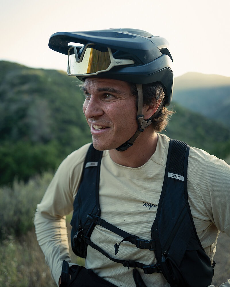
“What is the point of this?” asked my buddy Brad Potter upon receiving his invitation. “You’re insane, I’m glad I’m not doing this,” wrote Amado Stachenfeld, who eventually would get roped into photographing the day’s travails. Slowly but surely, like two little plankton floating through the murky depths toward an anglerfish’s lure, they reluctantly joined in.
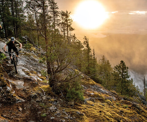
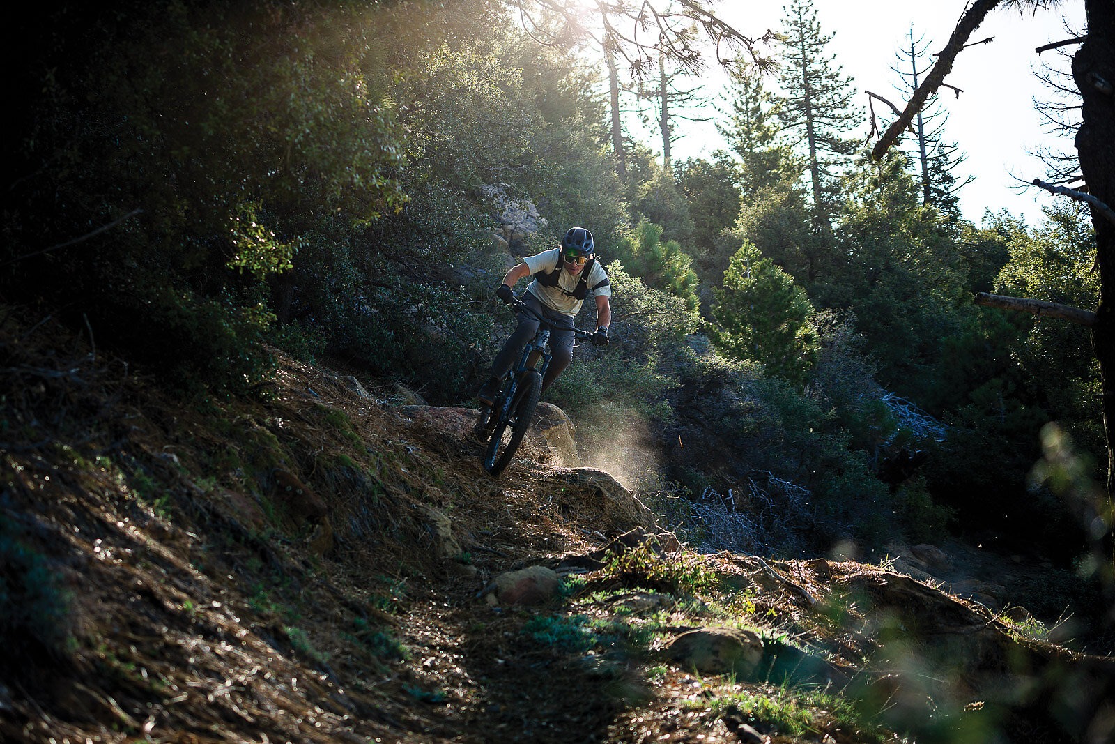
After careful consideration, I narrowed the hit list down to 16 trails for this day of trenching across the Transverse Ranges. From 15,000 feet of elevation dropped in the Topatopas to 9,000 feet of descending on Figueroa Mountain in the San Rafaels, the dirt ribbons that comprised this jour ney to the deep included Boulder Canyon, Chorro Grande, Ortega, Gridley, Pratt, Cold Springs, West Fork, Tunnel, Jesusita, Arroyo Burro (northerly and southerly aspects), Ranger Peak, Davy Brown, White Rock, Willow Spur, and Munch Canyon.
Hour Zero (6 a.m. & 0 fathoms deep)
We deemed it appropriate to begin our journey to the deep at the day’s highest point. A 40-min - ute shuttle in early morning light to basecamp at 7,000 feet atop the Topatopas laid the foundation for a rip on the e-bike—forgive me, but time was of the essence—past a U.S. Forest Service gate and up an access road to Reyes Peak. From here, Brad, Amado, and I gazed down upon the sun rising over the Mojave Desert before descending north toward its warmth into Boulder Canyon.
This trail first appears on maps from 1908, when the forest was still known as the Santa Barbara Forest Reserve. Likely established by Indigenous Chumash and used for thousands of years, it marks a clear path down a ravine, descending from pine forest to chaparral to cacti in a complete tour of central Californian ecological zones. On the trail, our tire lugs dig into loam, dust, and sandstone slab as we search for grip over the course of five miles and 3,300 feet of elevation drop between firs, oaks, mountain mahogany, and prickly pear. In less than 20 minutes, we’re sitting next to a wildfire ranger station, loading bikes onto a rack, and driving back to base camp. Back in turbo mode, we make quick work of getting back to the trailhead.
This time our sights are set south. Before dropping in, the three of us look out over the Pacific Ocean toward Channel Islands National Park, where distant mountains peek out in deepening shades of grays and blues as oblique morning light runs through a blanket of coastal humidity. As we grip into Chorro Grande’s sandstone layers, our suspension feedback acts as a stark reminder of the differences provided by the dip and strike slopes of a single mountain. Another five miles and 3,100 feet down beckons between agave and chamise—the trail’s long switchbacks hearkening back to those who first cut it for guiding donkeys up to carry phosphate out from the mines. As it runs out between massive con - glomerate slabs, we cruise up the Cherry Creek fire road for 1,700 vertical feet.
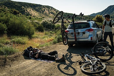
From Ortega Peak, a trail by the same name runs nine miles and 3,800 feet down rock gardens that would befit a World Cup downhill course. By now, we’re at a dash over 10,000 vertical feet of sustained difficult trail over 19 miles before breakfast. That’s an average trail grade of 10 percent, justifying—if not requiring—our early morning bowls of Wheaties. Thankfully, this shuttle isn’t over, as the car awaits at the visitors center just beneath Ortega’s exit. Here, we refill bottles in an old well and rinse our faces with cool water from Sespe Creek before a thousand-foot shuttle bumps us up to Rose Valley Road. One last use of e-bike batteries propels us up another climb to Nordhoff Ridge, overlooking Ojai.
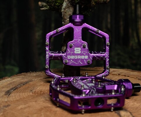
As the scents of citrus and creosote drift up from onshore ocean winds, a descent of 3,000 feet over six miles separates us from town. Gridley, a trail built solely for the purpose of tapping a natural spring so that a CEO from Standard Oil in the late 1800s could water his orchard, reflects its past as a roadbed designed for the traversing of mules and Model T cars with gentle grades and a forgiving lack of technical sections. Pratt, on the other hand, is an old horse trail from town to creek that is essentially one continuous rock garden. At the bottom of this trail sits my home, where a bike swap is made from my Specialized Kenevo SL e-bike to an analog Enduro.
Hour Six (11:45 a.m. & 2,167 fathoms deep)
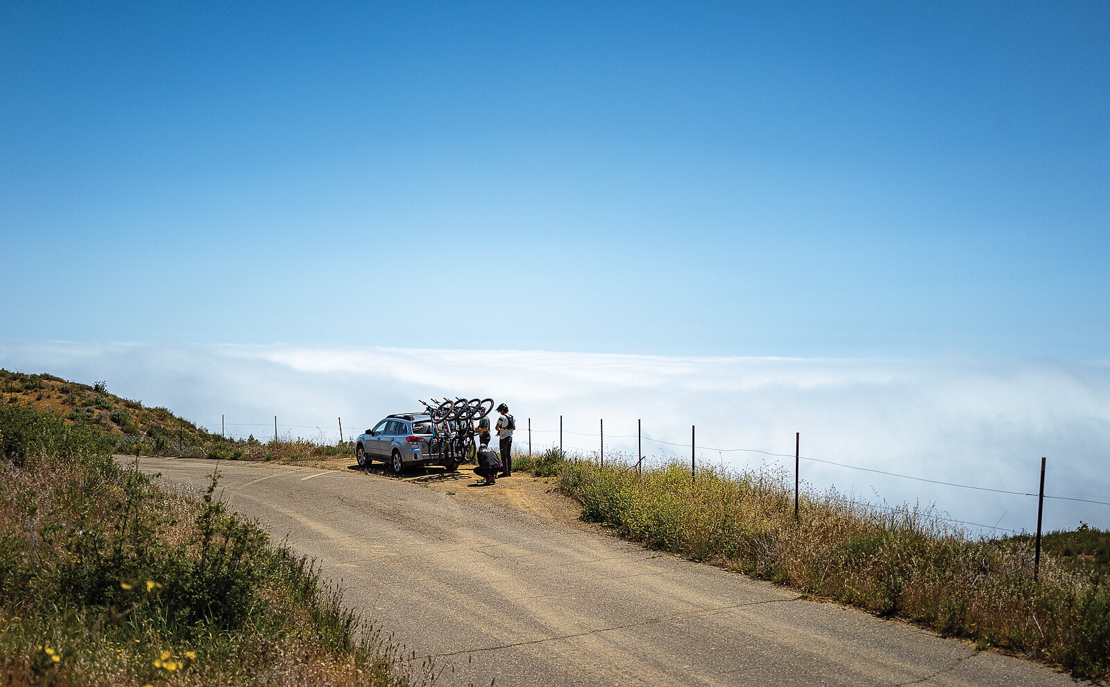
It’s an hour drive from Ojai to Santa Barbara, where a few substitutes to the team are to be made, namely the addition of one of the main trailbuilders in the region, Dave Bennett. In the car, I slam a burrito and a cup of coffee while watching waves peel off point breaks. Longboarders gracefully cross step while on trim across breaking faces glistening the color of steel in harsh sunlight. Nothing about our riding up until this moment has been graceful, perhaps more of a semi-controlled dance with gravitationally assisted falling.
Much of the elevation in Santa Barbara is made via Gibraltar Road, a Civilian Conservation Corps paved route intended as access from town up to the crest of the Santa Ynez Mountain Range and down to the Gibraltar Reservoir. It is from this ridgeline that fresh faces join me for a four-mile and 2,700-foot descent down the East Fork of Cold Springs. Their purpose is far more than just shuttle drivers, as they provide a renewed pace and vigor on the downhills as well as a reminder that community outweighs trial and tribulation, my callused hands and ever-decreasing grip strength aside. It is along this trail that Dave watches me nearly ride off trail down a 100-foot shale slide as Brad tumbles sideways after a botched Euro turn.
“We’re looking awfully loose for only being halfway done,” Dave says, chiding us as the dust settles and we get back on our bikes.
At the bottom, a truck awaits for a quick pop back up to the West Fork of Cold Springs, knocking out an additional 1,200 feet in the time it takes for the original shuttle rig to meet us once again for yet another lap up Gibraltar. For lacking grace, the coordination of cars and humans does hum with the energy of a concerto.
Atop La Cumbre Peak, more than eight miles of singletrack down 4,000 feet awaits in the forms of Tunnel and Jesusita trails, the former acting as a literal training course for World Cup downhill teams in the winter months, and the latter requiring a handful of trials moves to navigate steep switchback corners and creek crossings. At this point, our bikes and bodies are beat, but one last descent down this southerly aspect of the Santa Ynez to town is to be ridden: Arroyo Burro.
Arroyo Burro is split into two parts, one down the southern aspect and one northern, connecting coast to inland valley, both endowed with the same U.S. Forest Service inventory number and name. Alongside this trail, mortar bowls etched into rocks provide a direct glimpse into thousands of years’ worth of history embedded into this trail through countless fallen footsteps of Chumash, Spanish Padres, Mexican ranchers, and early American miners. The southern descent earns a quick 3,300 feet of drop down surfy shale chutes and long sandstone slabs, while the opposite slope down to the Santa Ynez River adds in an additional 2,100 feet on the way to our final mountain stop.

Hour Eleven (5 p.m. & 4,534 fathoms deep)
The Santa Ynez Valley is largely comprised of rounded, rolling, verdant green hills separated only by vineyards and ranches in wide, river-cut valleys. Through here, a turn is made up Happy Canyon Road toward Figueroa Mountain, a 4,500-foot sentinel of a peak that acts as a gateway to the San Rafael Mountains. Due to this peak having a near identical geologic makeup as Mount Tamalpais in Marin, some 300 miles north, its flanks are spattered in oranges and purples of California poppy and lupin flowers. At the summit stands a fire tower lookout, from which a ridgeline trail dumps a quick 650 feet in less than a mile. A single bar of reception allows my phone to pick up a few texts from Max Brau, whose presence was intended for this leg.
“Did you bring a light [laughing emoji],” reads Max’s message. “Too many beers at the river!”
A photo of him at the river provides the final bit of jest. But it wouldn’t be fun if a community didn’t have personality, and the laugh Max delivered via his message was worth more than fresh legs and fast riding at that point in the day.
Onwards, a connection is made across the saddle to Ranger Peak, where Davy Brown Trail is picked up underneath a grove of gnarled oak trees. This trail is named after a native of Ireland who lived out his days in a cabin built trailside around 1883, supported only by his adept marksman abilities, which he put to use on deer and bears to feed an ever-expanding population of miners and ranchers. From the ridge to his cabin is a 3.5-mile jaunt, losing 2,000 feet of elevation. It’s a quick trail to descend by bike, but a hell of a long way to bring several hundred pounds of freshly harvested meat to town. Sticking with that theme, the next trail on the agenda, Munch Canyon, consists of 3.5 miles of stellar, loamy traverses down 2,200 feet, all under the namesake of a late 1800s man who preferred the solitary nature of living on the backside of a mountain amidst trout streams to an adobe abode amongst missionaries.
In a slight shift of history and geology, White Rock Trail offers 1,600 feet of drop through chaparral-lined white rock, sandstone trail bed, interspersed by old mine tailings and a rusting 1960s jalopy more than a mile from the closest dirt road where chrome ore was once pulled from the earth.
No one cares about this day except us, but perhapsthat’s exactly what mountain biking always hasbeen and needs to stay—a pursuit of joy andadventure for no one else but ourselves.
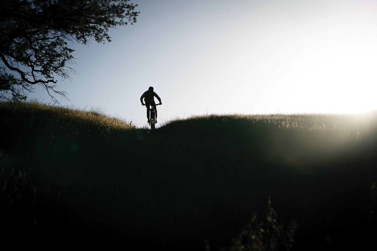
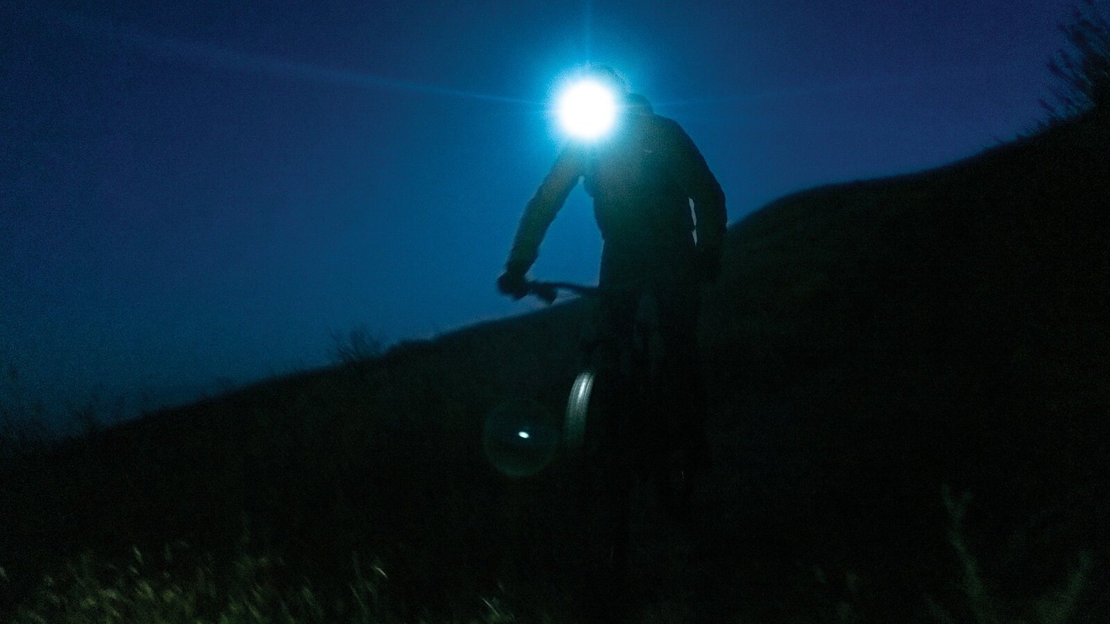
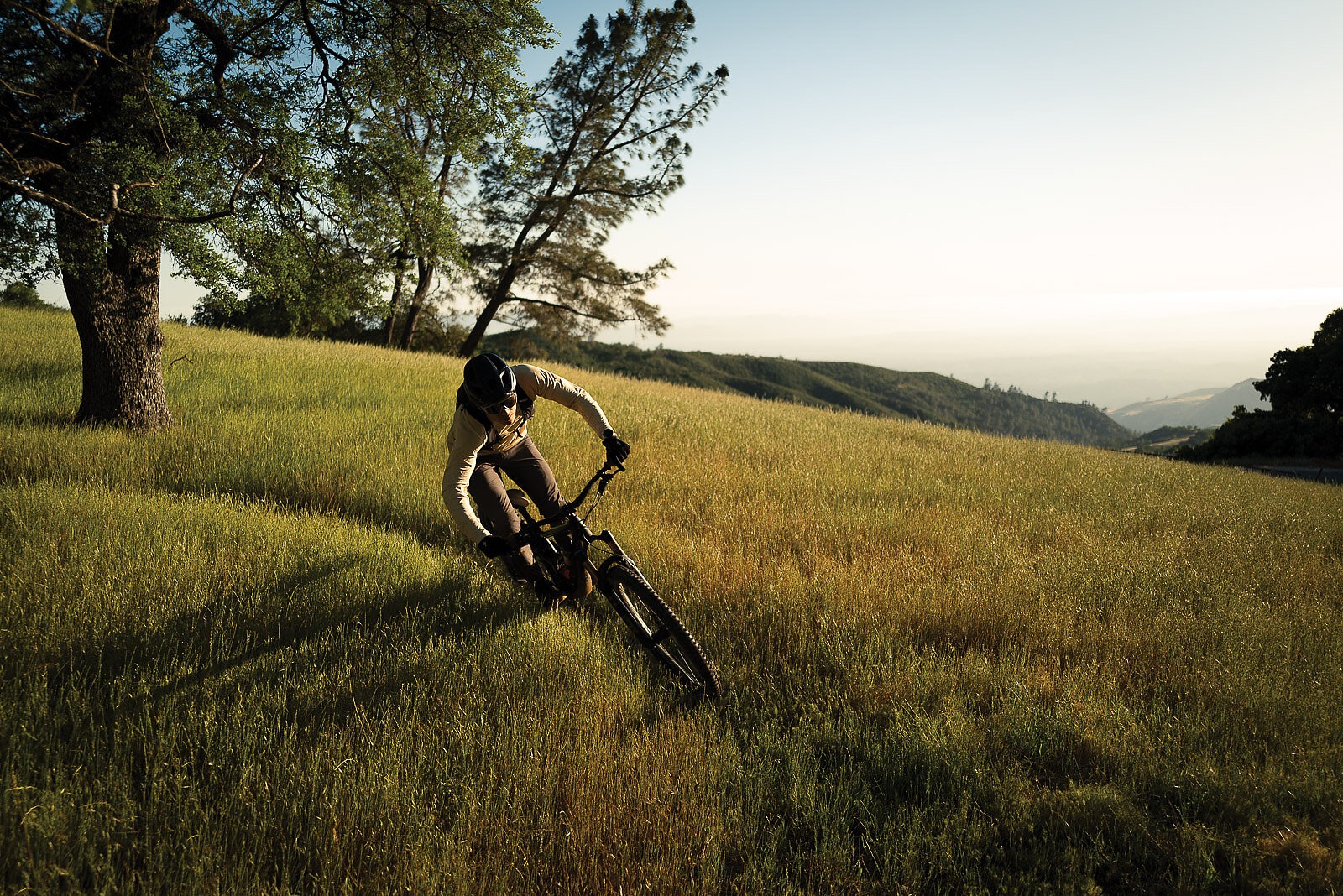
At this point, our eyes had gone bleary and bloodshot, and our hands were stiff and cramped in the shape of grips, whether on bike or off. One last drive up the ridge under dying light led to a cold metal gate at the end of a grassy field facing southwest toward the sunset. Under any other circumstance, this would be an easy cruise fit for a 140-millimeter trail bike, only requiring half of an attention span while the mind drifts off to distant views. Instead, these last four miles and 2,200 feet of descent, through waist-high wild grasses and wildflowers, pass in a blend of flow state and prayer that a day jammed with a month’s worth of riding can be escaped without mechanical or injury.
A long, arcing turn around the trunk of a fir, boughs drooping to the ground, creates as close of an experience to being pitted on a bike as one can find and opens up into our last stretch of trail. In this golden, glowing grassland, long pink clouds and gray-shaded peaks provide a backdrop as we collapse against the same car that we began the day inside. At 9 p.m., after 80 miles and 15 hours of trail riding, beers and a bottle of bourbon are cracked as we down beef jerky and tortilla chips. Between bursts of laughter and an ever-increasing urge to roll up into my sleeping bag once the leg cramps stop, all I can gather is a realization that while I’m proud to have helped build the network of trails and community that made this all possible, all of it is still incredibly small in the grand scheme of things.
No one cares about this day except us, but perhaps that’s exactly what mountain biking always has been and needs to stay—a pursuit of joy and adventure for no one else but ourselves. We give back in service of the land and culture, but for nothing more than a prelude for it to exist at all.
The sky grows dark, not unlike the inky depths of the lowest point on Earth. I look up into the blackness. Here we are, 5,969 fathoms deep.