Line of Control A Journey to the Roof of India
When one uses the statement “beyond the line of control” in reference to a mountain bike trip through a remote, high-altitude region of India, it should raise a few questions.
Add the fact that this area, Ladakh—a bastion of Tibetan culture hemmed in by the mighty Himalaya, Karakorum, and Zanskar mountain ranges—is a geopolitical hotbed of border skirmishes, and these questions truly start to mount.
To the north and east of Ladakh is Tibet, long controlled by the People’s Republic of China and governed by faraway Beijing. The disputed border between India and China, known as the “Line of Control” (LOC), has for decades been the scene of periodic border battles. And to the west, the border with Pakistan is the site of the world’s longest-running, high-altitude military stalemate between India and Pakistan over a heavily glaciated expanse of terrain.
Due to the volatile situation surrounding the LOC, few foreigners are allowed to enter the highly militarized region, much less to bring bikes into the zone. To do so, special permits are required, and after submitting our proposed route to the powers that be and waiting for days to receive approval, we finally got the necessary permission—along with the caveat that we could be turned back at any time due to quickly changing events. My teammate for the adventure is Vinay Menon, a freerider from Pune, India who is no stranger to treacherous backcountry terrain.
Excited over obtaining permission, we contacted our old friend Stanzin Dorje, a bike shop owner in Ladakh’s capital city of Leh who also had the needed 4x4 vehicle that would transport us over the high dirt-road passes that would provide us access to the virgin slopes we hoped to ride on two wheels—ushering in the secondary meaning of the “Line of Control.” Picking unridden downhill lines while keeping our bikes under control would be the primary objective of this trip.
Loaded with bikes, a stove, a tent, and food staples of peanut butter and chapattis provided by local homestay owners, the three of us set out in Stanzin’s Mahindra pickup, heading past the major military encampments surrounding Leh on the way to the mountainous terrain beyond. In the distance, ancient monasteries are perched high on rocky outcrops, surrounded by whitewashed chortens that long lined the overland trade routes through Central Asia and India leading into China. As we follow the mighty Indus River toward the eastern edge of Ladakh, traffic becomes lighter but military checkpoints grow more numerous. Without our permits, we would surely be turned back.
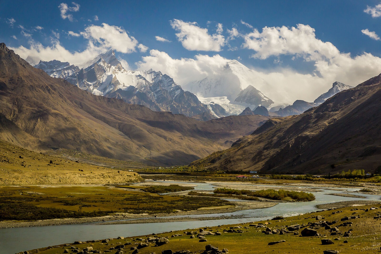
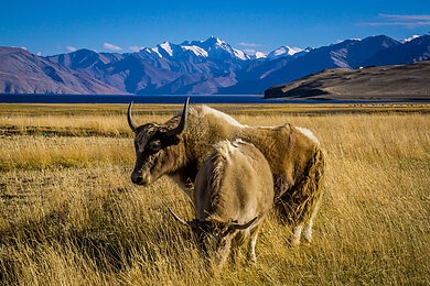
Our initial destination is Tso Moriri, a high-altitude lake nestled on the Changthang Plateau. Fed by glacial melt from the towering peaks that envelop the plateau, Tso Moriri is the largest of India’s high-elevation lakes. Though the spring thaw had begun, the roads were still ice covered as we approached the small lakeside village of Karzok. In the distance, snow-covered peaks jutted into the clear-blue sky, providing a stunning backdrop for the lines that Vinay and I hoped to ride. We pulled out shovels to prep some lines, scraping takeoffs and landings with an eye toward safety. With the wind blowing off the lake below, the air was bitterly cold, and hiking our bikes at this altitude meant we only wanted to hit the lines a few times. But with snow-capped, 23,000-foot-high peaks in the background and an ice-covered lake below, we were rewarded with the views and the knowledge that we were likely to be among the first to ride downhill bikes on these slopes.
Early the next day we set off for Pangong Tso, which at 13,862 feet above sea level is the world’s highest saline lake. Much of the lake straddles the disputed area between India and China, making it serve as a de facto border between the two countries. Ever since the Sino-Indian War over this territory took place in 1962, tensions between the two countries have been high in this region, and the area around the Line of Control has been the scene of periodic combat between the two militaries. As we approached the village of Chushul, we were flagged down at a military checkpoint and asked to produce our passports and travel permits, along with our planned route. We were allowed through but advised not to deviate from our plan, given the close proximity to the Chinese border.
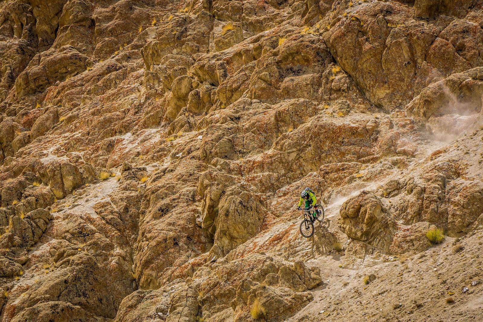
Driving alongside this deep-blue lake, we scanned the surrounding brown slopes in search of rideable terrain. Rounding a curve, we spotted a rocky outcrop high above the blue waters. Though the shale looked loose, we decided to give it a closer inspection. Vinay set out along a narrow ridgeline, pointed his front wheel downward and started snaking his way down the slope, finally bottoming out at the water’s edge far below. Shouldering his bike, he began the long hike-a-bike back up to the top. Due to the frigid wind and the rigors of altitude, two more attempts was enough for Vinay, but he had already set the bar high.
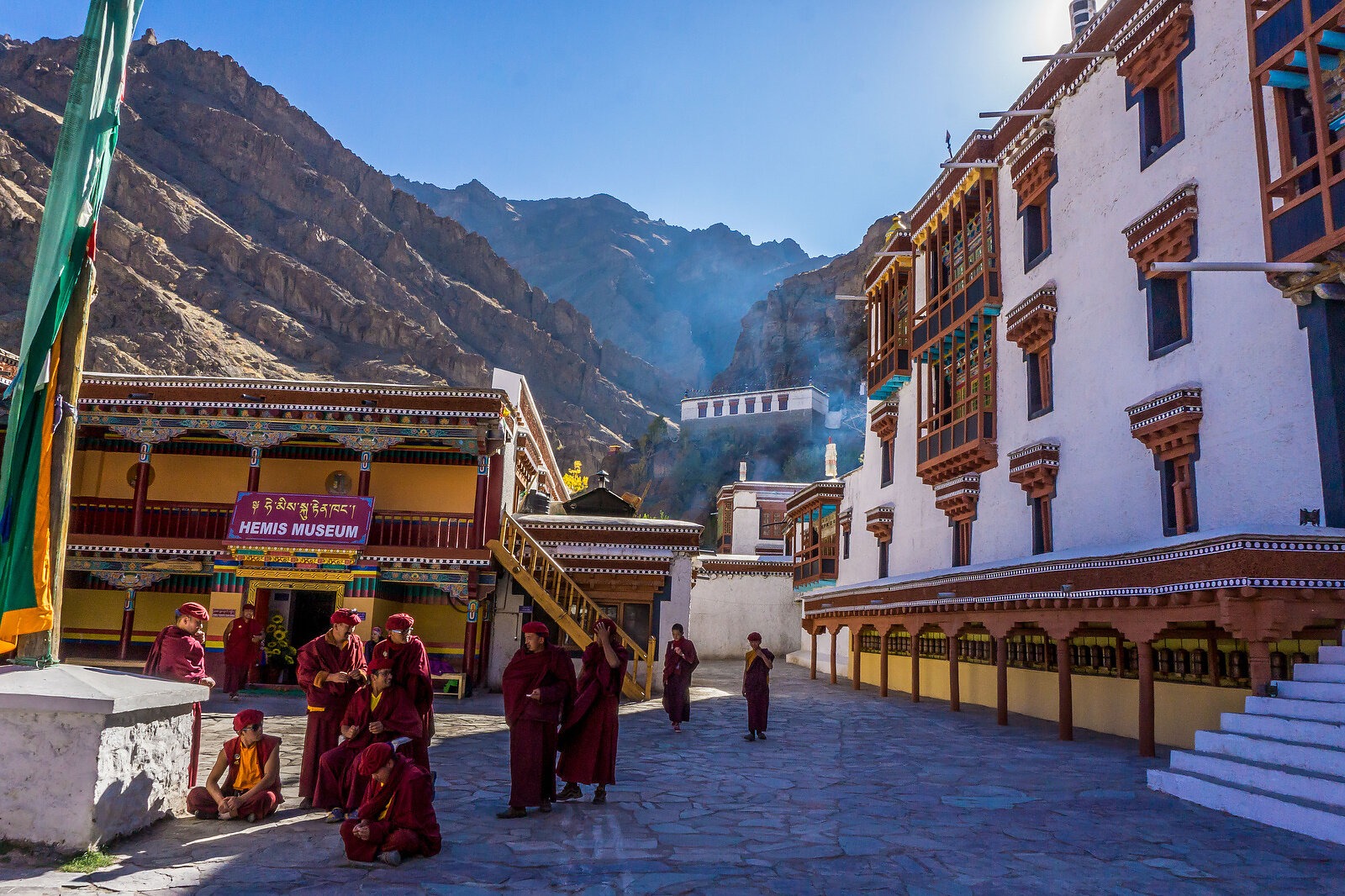
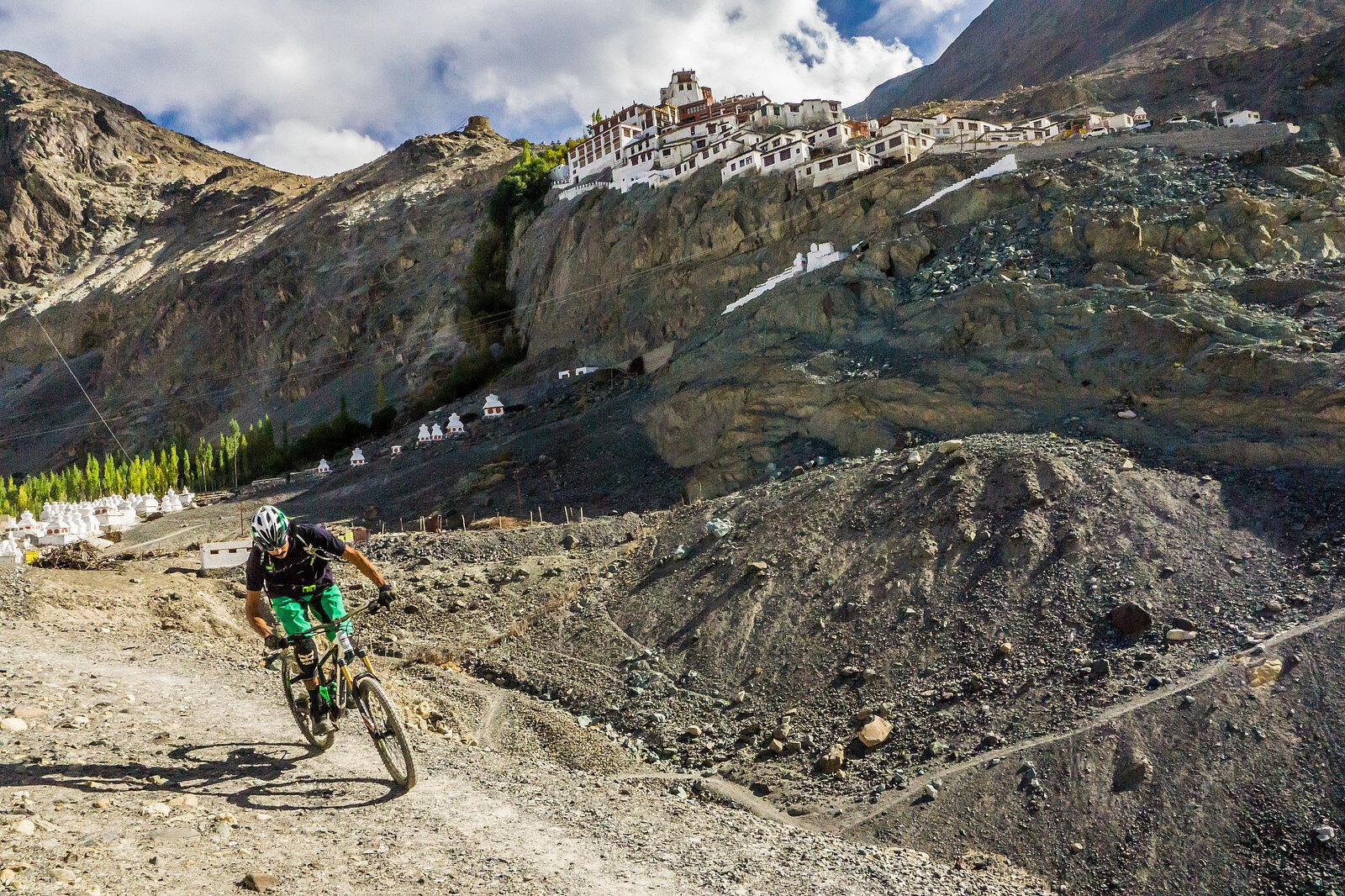
After finding a place to stay, some hot tea and food, we searched the map for a new route toward the Nubra Valley, which runs parallel to China along the Shyok River. Leaving early the next morning, we set out on the rough road to the village of Diskit. The journey was slow and arduous, and we didn’t arrive until dusk. Fortunately, Stanzin had family there, and we were greeted like old friends. The next morning, we were treated to a view of the beautiful Diskit Monastery high on the slopes above—where we hoped would be the next place to put tires to the dirt.
We were elated to find a line below the massive, 100-foot-tall statue of the Maitreya Buddha near the monastery. The twisting footpath that ascended to the monastery made for a fast and flowy descent, allowing Vinay the opportunity to let off the brakes and carve some new turns. Afterwards, we rode among rows of white chortens and alongside walls of carved stones inscribed with Buddhist prayers amid the sounds of monks chanting, beating cymbals, and blowing low-octave horns. The overall atmosphere was surreal, making Ladakh even more of a joy to experience.
After a family breakfast the next morning, we loaded the bikes for the drive toward the village of Turtuk, sandwiched between the Karakorum and Himalaya ranges. The road ran alongside the Shyok River and featured multiple security checkpoints where we were asked to produce our passports and permits. The Buddhist cultural influence gradually waned and was replaced by a Muslim one as we drew closer to Turtuk, the last stop before the Pakistan LOC. The Balti people who live here are originally from the Baltistan region of Pakistan, part of which was taken by India during its 1971 war with its neighbor. Of the five villages seized during this conflict, Turtuk is the largest—and, judging from the fact that we were not allowed to proceed further, it is clearly a sensitive zone.
After being turned away, we decided to drive higher to the hamlet of Takshi, situated near the end of the dirt road. We unloaded the bikes and hiked high into the fields above the Shyok River along a narrow path on which donkeys are used to transport goods and building materials into the area. As we entered the green fields filled with irrigation channels we were greeted by locals with the phrase “as-salaam alaikum” (“peace be with you”), underscoring the fact that we were now in the Muslim sector of Ladakh. In the distance, the trails that Indian soldiers used to defend the LOC were visible—as were the landmine warning signs that reminded us we were riding in a conflict zone. In this moment, we were balancing on the knife-edge of the Line of Control.